LUC provides interactive visualisation for CPRE Star Count
LUC provided an interactive visualisation of data as part of CPRE’s Star Count campaign.
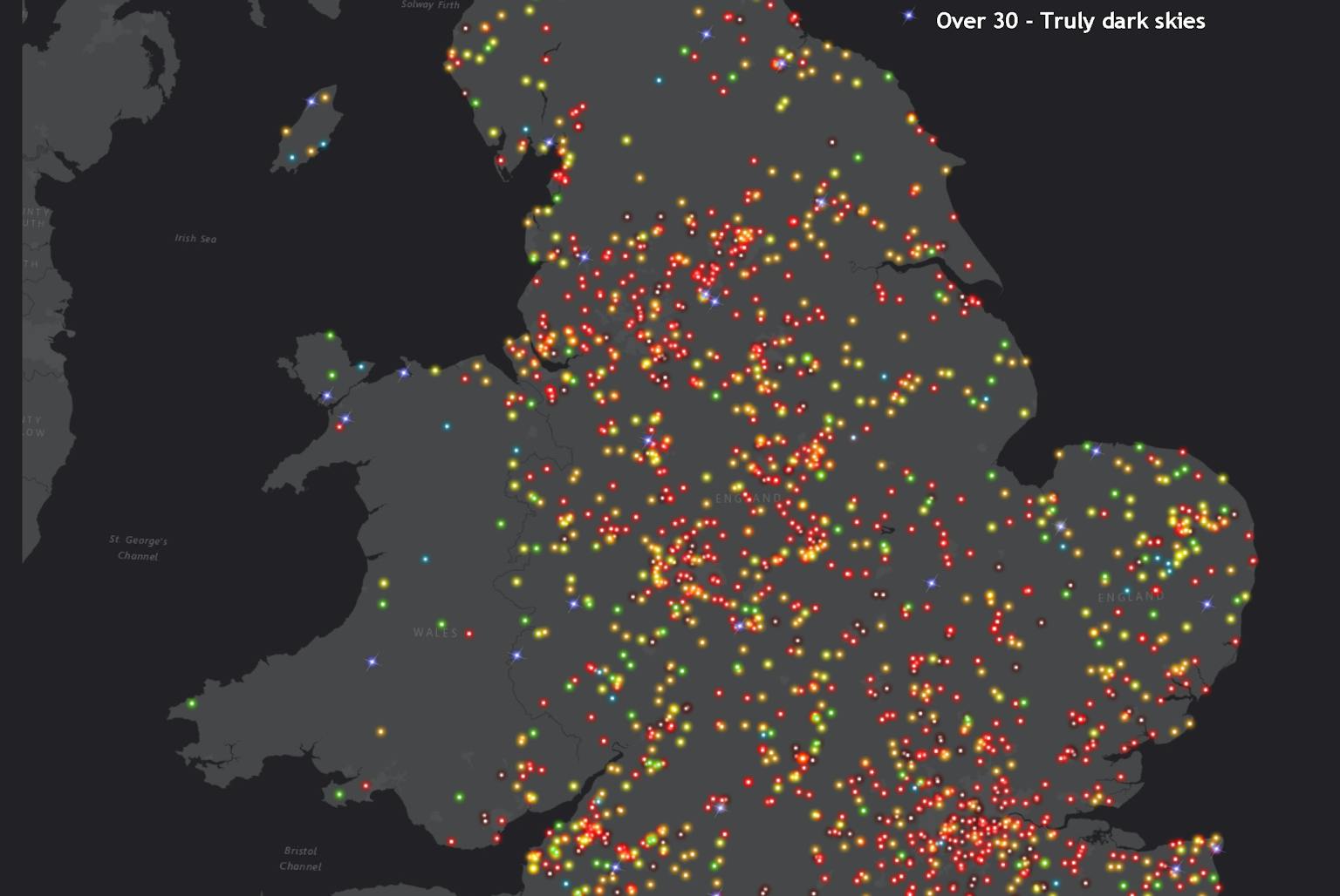
Our GIS & Visualisation team used data collected by 2,300 participants across the UK in a star-spotting survey and presented it in a visually interesting way using Esri technology. The Star Count 2019 map can be explored here.
The project forms part of CPRE’s call for action to tackle light pollution to enable more people to enjoy the beauty of a starry sky. Results of the survey reveal that just 2% of participants experienced a truly dark sky full of stars. This is due to the impact of light pollution caused by street lighting and other artificial lights.
Star-spotters submitted the number of stars they could see within the constellation of Orion. We used the results to create an interactive map displaying people’s view of the night sky. It also demonstrates the impact that light pollution is having on people’s view of the stars.
Learn more about CPRE’s campaign here.
Contact Diana Manson to talk to us about our GIS & Visualisation services.
Recent news
 News, 11 December 2025
LUC attends Scottish Green Energy Awards 2025
Living Wage Week is here! 🎊 We’re proud to celebrate being part of a movement of over 16,000 employers making a difference by paying the real Living Wage - because everyone deserves a decent standard of living.
LinkedIn, 13 November 2025🌍 Thank you to everyone who joined our Mapathon. Whether you participated online or in the office, your efforts made a real impact. Together, over 40 attendees mapped 4,727 buildings in northern Côte d’Ivoire, where Médecins Sans Frontières is supporting refugees.
LinkedIn, 24 November 2025