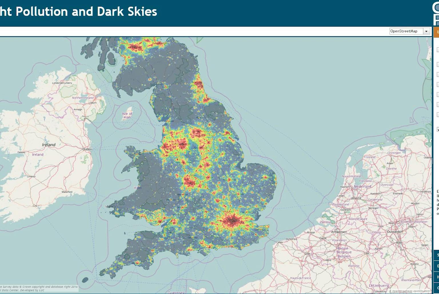
How dark are our skies?
Campaign to Protect Rural England (CPRE) has launched ‘NightBlight’ today, the most detailed interactive maps of England’s light pollution and dark skies ever created for Britain.
LUC created the maps, analysing the latest available satellite data to create interactive maps that shows how light pollution is distributed around the country and where the darkest skies are.
CPRE has long been a leading voice in the campaign against light pollution. This new mapping work builds on previous work undertaken by LUC and CPRE in 2003 to show the extent of light pollution in the UK in 1993 and 2000.
Diana Manson, LUC’s Head of GIS and Visualisation says “We are delighted to be working with CPRE again to support their work through the development of these maps. We believe that this updated data will provide a fantastic evidence base to support a range of our clients’ work in landscape protection and management and to inform planning decisions.”
If you are wondering how dark the skies in your area are compared to other locations around the UK, have a look here: http://nightblight.cpre.org.uk/