


LUC GIS & Visualisation team making waves
LUC’s GIS & Visualisation team has been appointed by Historic England to consolidate the eight existing Historic Seascape Characterisation projects into a single national Historic Seascape Characterisation database.
This research consolidation will add considerable value to the funding, effort and time already invested in Historic Seascape Characterisation. It will result in an accessible national baseline dataset for England’s historic seascape character that will inform strategic management of change within the marine and coastal environment.
This project builds on our recent work for the Marine Management Organisation, which includes completing a Seascape Character Assessment for the South West Marine Plan Area, and our research study undertaking Scotland’s first national survey of marine recreation and tourism around the coast.
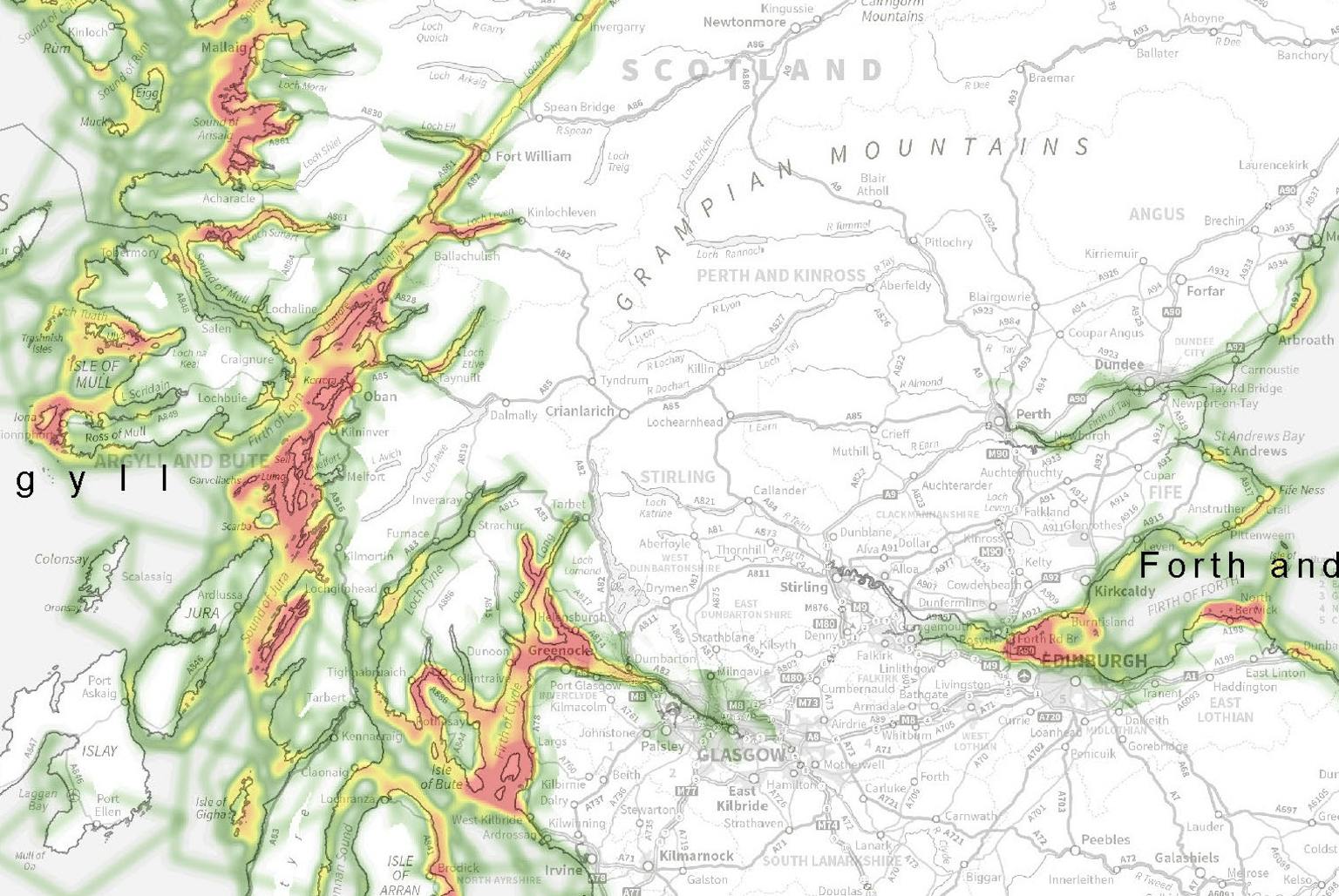
Scottish marine recreation and tourism study
GIS has been central to delivering these exciting projects where we’ve used interactive web mapping tools to collect spatial data. The data collected results in a suite of heat maps identifying areas of intense activity around Scotland’s coastline.
We presented some of these tools and let delegates play around with the GIS data at our 50th anniversary event in Bristol on 21 April – contact Gemma Bosworth to see the outputs.
Recent news
 News, 5 December 2025
LUC sponsors Women in Planning dinner at Regen Planning Conference 2026
 News, 19 January 2026
Welwyn Hatfield Borough Council’s Green Corridor
 News, 3 December 2025
Natural England publishes new blog and film featuring LUC water meadows research