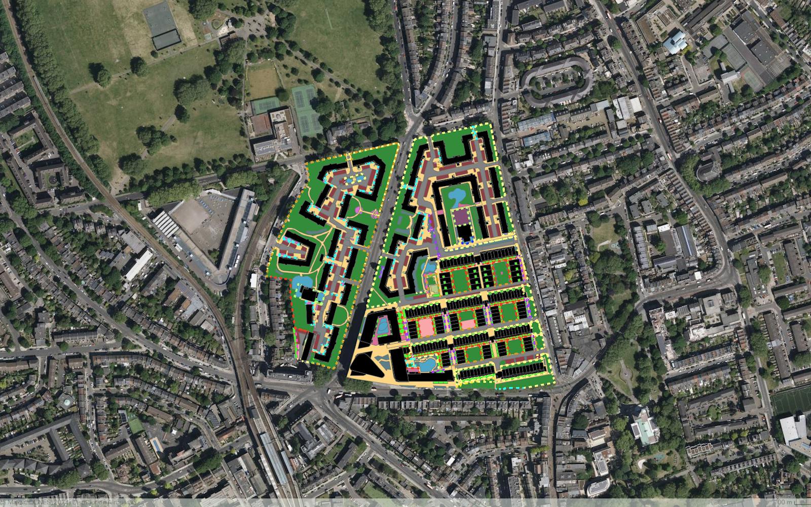
LUC maps Peabody's open space assets
This year, LUC delivered an extensive mapping exercise to capture reliable and accurate Geographic Information System (GIS) data covering Peabody’s open space assets.
LUC has a long relationship working with the housing association – from landscape design to the strategic management of open spaces.
Drawing on these established relationships, we brought together key stakeholders within Peabody to define an asset typology for the mapping. This ensured that any new data we collect integrates with existing structures and platforms.
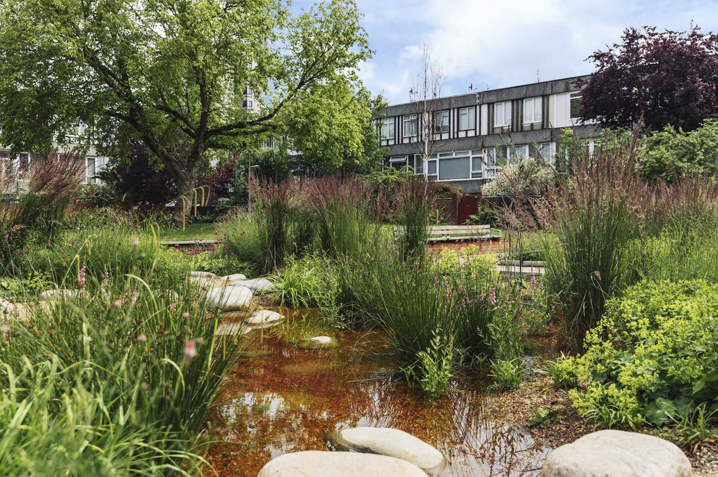
When complete, the detailed mapping will help inform strategic priorities and enhancement opportunities across the Peabody portfolio.
We are mapping in GIS using 10cm aerial photography and other existing schedules and mapping. LUC's experienced landscape managers have undertaken field verification of the GIS data using our GIS-based fieldwork tools.


To provide additional data for the future management and maintenance of a selection of open spaces, our Landscape Managers have undertaken over 300 open space quality audits.
These quality audits, modelled on the Green Flag Award criteria, provide detailed information on the condition and presence of features within estates. They help Peabody to understand the extent of its liabilities relating to estate management. The surveys repeat audits we undertook in 2016 and provide evidence of the impact of investment across Peabody.
Recent news
The most in-demand skills in planning consultancy 2025
Planning ResourcePress, 10 December 2025 News, 10 December 2025
LUC sponsors national climate planning guide for local authorities
 News, 19 November 2025
LUC ranked among top UK environmental and sustainability consultancies