LUC’s GIS & Visualisation team nominated for top national research award
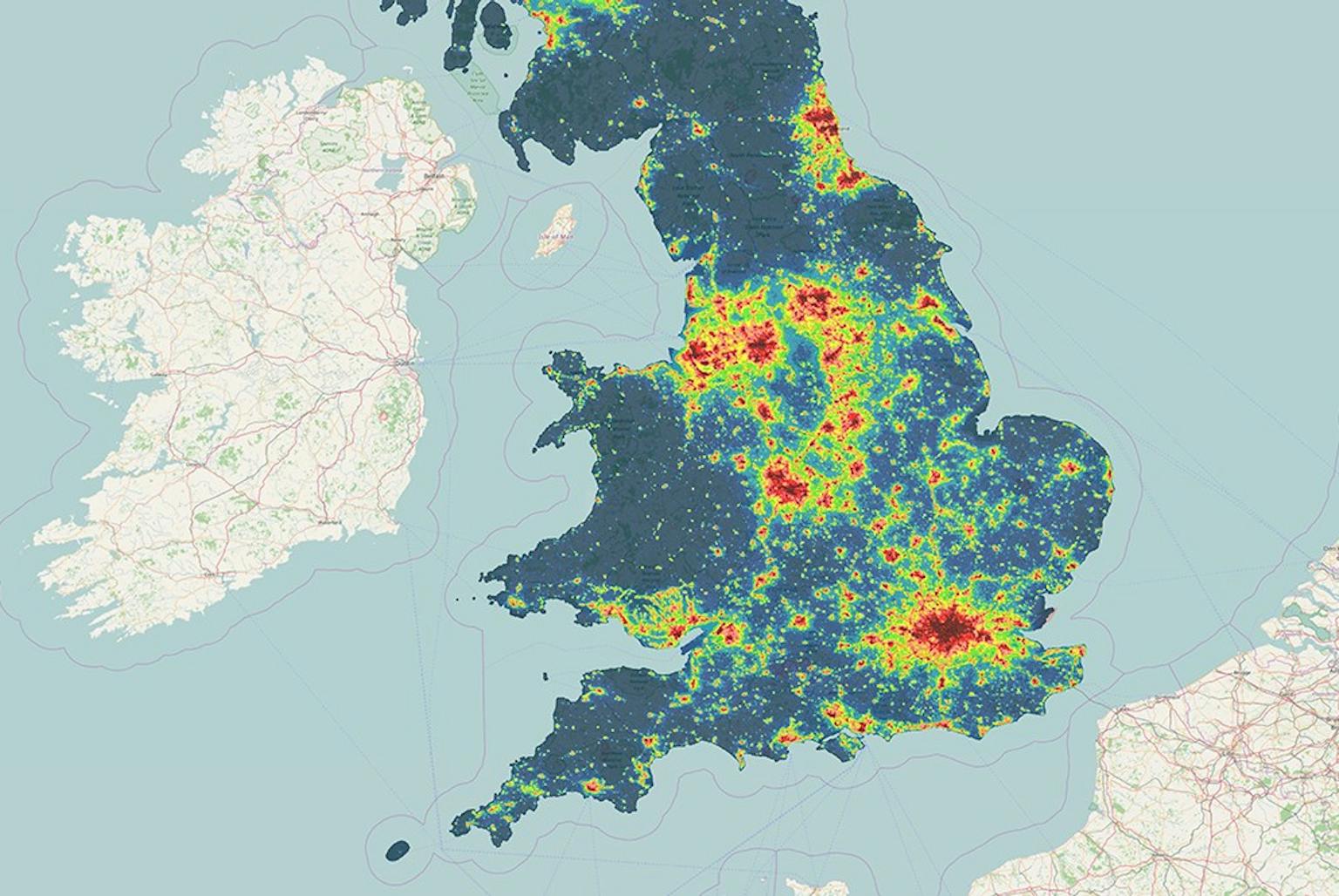
We’re pleased to announced that members of our GIS & Visualisation team are finalists in the Consultants Award category at the 2017 Royal Town Planning Institute’s (RTPI) Awards for Research Excellence for our ‘Night Blight: Mapping England’s Light Pollution and Dark Skies’ project.
Our GIS team used data gathered by the United States National Oceanic and Atmospheric Administration (NOAA) Suomi NPP satellite to create an interactive map and supporting analysis to show how light pollution is distributed around the country and where the darkest skies are. Within the interactive map, users have the ability to zoom in to postcode level as well as add contextual layers to aid interpretation. PDF maps with summary statistics are available for each local authority, county, region, designated landscape and National Character Area. There has been significant interest in the maps and research, including local authorities who are actively using the data to develop lighting policies, use of the data to support Sustainability Appraisal and use of the data in Landscape Character Assessment.
The Awards for Research Excellence are run by the RTPI to recognise and promote high quality, impactful spatial planning research from RTPI accredited planning schools, and planning consultancies around the world.
The awards ceremony will be held on Tuesday 12 September at Queen’s University where the winners will be announced.
To see how dark the skies in your area are compared to other locations around the UK, have a look here.
Recent news
🌍 Thank you to everyone who joined our Mapathon. Whether you participated online or in the office, your efforts made a real impact. Together, over 40 attendees mapped 4,727 buildings in northern Côte d’Ivoire, where Médecins Sans Frontières is supporting refugees.
LinkedIn, 24 November 2025 News, 6 November 2025
Have your say on Westmorland and Furness Design Code
 News, 28 November 2025
LUC commended at RTPI Awards for Planning Excellence 2025