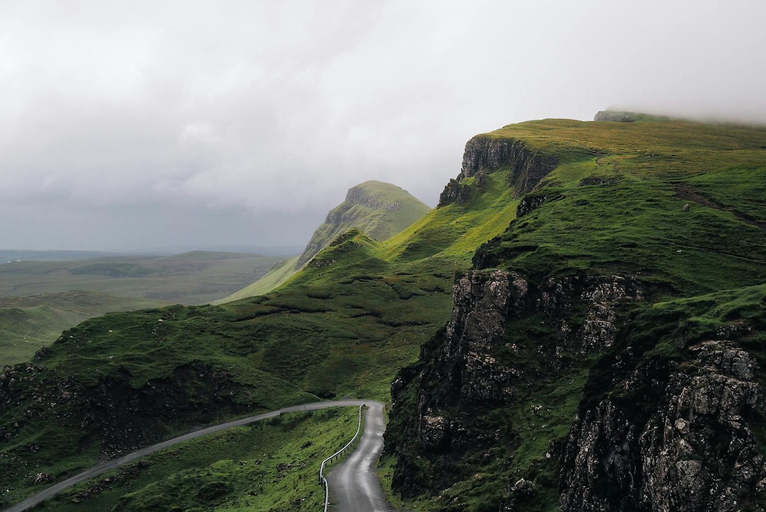
Wild Land Assessment in Scotland
What are Wild Land Areas?
Areas of Scotland which exhibit strong indicators of wildness, as defined by Scottish Natural Heritage (SNH), are known as Wild Land Areas (WLAs). Their importance is formally recognised in National Planning Framework 3 (NPF3)[i] and in Scottish Planning Policy (SPP)[ii]. NPF3 recognises wild land as a ‘nationally important asset’ while SPP notes that development plans ‘should identify and safeguard the character of areas of wild land’. Although not a statutory designation, WLAs and their component qualities of wildness are considered nationally important.
The location and extents of WLAs were published by SNH in 2014, superseding earlier ‘Search Areas for Wild Land’ (2002) and ‘Core Areas of Wild Land’ (2013). As such, there are two current sources of information relating to the identification and assessment of potential impacts on wild land in Scotland:
- The series of 42 SNH ‘Descriptions of Wild Land Areas – 2017’;
- The consultation draft 2017 SNH guidance document: ‘Assessing Impacts on Wild Land Areas – Technical Guidance’[1].
The opening paragraph of the 2017 guidance explains: ‘Wildness is a quality which people experience. Wild land areas are the most extensive areas where these qualities are best expressed. Physical attributes and perceptual responses are the measure by which changes in experience are to be assessed’. Wild land qualities are seen as a combination of physical attributes and perceptual responses to them; the former being relatively easy to define and the latter being concerned with the way people react to them.
How are effects on Wild Land Areas assessed?
LUC is at the forefront of developing methodology for undertaking WLA assessments, both through providing comment to SNH to assist in refinement of the guidance, and in undertaking such assessments. WLA assessments tend to accompany a detailed Landscape and Visual Impact Assessment (LVIA), the latter being undertaken in accordance with the Guidelines for Landscape and Visual Impact Assessment, third edition[2] (GLVIA3). The WLA assessment process typically involves:
Defining the study area
LUC’s in house GIS team prepare Zones of Theoretical Visibility (ZTVs) and Cumulative ZTVs (CZTVs). These help to identify areas where a proposed development may or may not be visible in the landscape. They are based on a ‘bare ground’ computer generated terrain model and therefore represent a ‘maximum potential visibility’ scenario.
WLA assessment considers effects on WLAs which fall into the study area for each LVIA. The often mountainous or upland terrain of these areas strongly influences the potential for visibility, so as a first step examination of a ZTV helps in understanding which areas could be affected. Attention can then be focused on the areas where the ZTV indicates potential for a development to be seen, although each WLA is also considered as a whole.
Defining sensitivity
The sensitivity of WLA attributes and qualities is informed by field survey work and the WLA descriptions (SNH, 2017), and takes account of value and susceptibility, as required by GLVIA3.
The value of attributes and qualities of WLA is typically considered to be high because of their inclusion in WLA descriptions and the protection afforded by SPP, but detailed fieldwork helps to draw out variations throughout the WLA. Similarly it helps in determining the susceptibility of the relevant attributes and qualities to the change proposed. Judgements on susceptibility are informed by an understanding of the strength of the attributes and qualities identified in each area, and the potential for the proposed development to affect them.
Defining magnitude and significance of effect
Determining magnitude of effect is based on combining professional judgements on size and scale, geographical extent, duration and reversibility of the change, as required by GLVIA3. When determining the significance of effect, it is necessary to consider effects on the attributes and qualities of the WLA as they are experienced from within the WLA.
The significance of effects is considered in terms of effects on the qualities and attributes of the WLA, as distinct from the landscape and visual effects identified through LVIA. As such the WLA assessment provides an additional tier of information when it accompanies LVIA.
How can effects on Wild Land Areas be reduced?
Given the typically open and undeveloped nature of WLAs, mitigation through sensitive siting and design is an important consideration and something that LUC plays close attention to. Examples of ways to reduce the potential for adverse effects on WLA include:
- Involvement of LUC early on in the site selection process in order that this process is informed by an understanding of the potential effects and the degree to which they can be mitigated;
- When it is not possible to select sites outside WLAs, responding to the terrain and aiming to locating project components where they will be less visible, utilising natural screening provided by the landform, or designing project components to improve their fit with the landscape;
- Exploring options for landscape and habitat restoration alongside a proposed development for example promoting heathland or native woodland regeneration within WLAs;
- Having an early understanding of when positioning new development alongside existing development can help to reduce and mitigate effects on WLAs, for example by limiting effects to areas which are already affected; and
- Considering the need for lighting and how this can be reduced, given its potential to affect dark skies within WLAs.
[1] SNH state on their website that the consultation draft guidance should be applied in place of the 2007 guidance while consultation responses are considered: https://www.nature.scot/assessing-impacts-wild-land-technical-guidance-2017
[2] Landscape Institute and Institute of Environmental Management and Assessment (2013), Guidelines for Landscape and Visual Impact Assessment (GLVIA3)
[i] Scottish Government (2014) National Planning Framework 3 (NPF3)
[ii] Scottish Government (2014) Scottish Planning Policy (SPP)